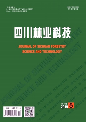
WE ARE COMMITTED TO REPORTING THE LATEST FORESTRY ACADEMIC ACHIEVEMENTS

Volume 40 Issue 5
Nov.  2019
Article Contents
Turn off MathJax

WEI Ying, ZHENG Yong, ZHANG Qiang, QING Yu-ling, LIU Zong-xue. Spatial Distribution Patterns of Land Use in Xichang City under the Constraint of Complex Terrain[J]. Journal of Sichuan Forestry Science and Technology, 2019, 40(5): 17-22. doi: 10.16779/j.cnki.1003-5508.2019.05.004
Citation: WEI Ying, ZHENG Yong, ZHANG Qiang, QING Yu-ling, LIU Zong-xue. Spatial Distribution Patterns of Land Use in Xichang City under the Constraint of Complex Terrain[J]. Journal of Sichuan Forestry Science and Technology, 2019, 40(5): 17-22. doi: 10.16779/j.cnki.1003-5508.2019.05.004

Spatial Distribution Patterns of Land Use in Xichang City under the Constraint of Complex Terrain


doi: 10.16779/j.cnki.1003-5508.2019.05.004
More Information
  • Received Date: 2019-07-19
  • Xichang city was taken as the research area. Based on the land use data obtained by DEM and remote sensing interpretation, the distribution characteristics of land use under the influence of four terrain factors were obtained by superposition processing of extracted topographic factors (elevation, slope, aspect, topography) and land use status map with the support of GIS software and spatial technology. And the coupling relationship was further analyzed between land use spatial distribution and topographic factors. The results showed that (1) the land use type in Xichang City was mainly forest land, accounting for 50.51% of the total area. The area size of grassland was close to that of cultivated land, paddy field, or construction land, and the proportion of water body and other land types were small; (2) Each land use type showed a law of ladder change in different elevation, slope and topographic level; the land use degree of sunny slope and semi-sunny slope was higher than that of shady slope and semi-shady slope, and the water body was not affected by slope direction; (3) Land use types in Xichang City were relatively strictly limited by topographical factors, and currently, there was no extremely large-scale distribution caused by strong human disturbances and geological disasters.
  • 加载中
  • [1] 李秀彬.全球环境变化研究的核心领域——土地利用/土地覆被变化的国际研究动向[J].地理学报,1996(06):553~558.
    [2] 王思远,刘纪远,张增祥,周全斌,赵晓丽.中国土地利用时空特征分析[J].地理学报,2001(06):631~639.
    [3] 李秀彬.土地利用变化的解释[J].地理科学进展,2002(03):195~203.
    [4] 左大康.现代地理学词典[M].北京:商务印书馆,1990.
    [5] 李丹,刘丹丹,赵金祥.基于DEM的山区土地利用变化分析[J].水土保持研究,2014,21(01):66~70

    +2.
    [6] 杜国明,匡文慧,孟凡浩,迟文峰,陆灯盛.巴西土地利用/覆盖变化时空格局及驱动因素[J].地理科学进展,2015,34(01):73~82.
    [7] 贾宁凤,段建南,乔志敏.土地利用空间分布与地形因子相关性分析方法[J].经济地理,2007(02):310~312.
    [8] 孙丽,陈焕伟,潘家文.运用DEM剖析土地利用类型的分布及时空变化——以北京延庆县为例[J].山地学报,2004(06):762~766.
    [9] 邱扬,傅伯杰,王军,陈利顶.黄土丘陵小流域土地利用的时空分布及其与地形因子的关系[J].自然资源学报,2003(01):20~29.
    [10] 龙花楼,李秀彬.长江沿线样带土地利用格局及其影响因子分析[J].地理学报,2001(04):417~425.
    [11] 黄志坚. 面向对象影像分析中的多尺度方法研究[D].国防科学技术大学,2014.
    [12] 王云豹,罗菊春,崔国发.我国自然保护小区的现状特征分析——以浙、赣、闽三省部分县为例[J].江西林业科技,2006(03):47~50.
    [13] 周成虎,程维明,钱金凯,李炳元,张百平.中国陆地1:100万数字地貌分类体系研究[J].地球信息科学学报,2009,11(06):707~724.
    [14] 马士彬,张勇荣,安裕伦.山区城市土地利用动态空间分布特征——以贵州省六盘水市为例[J].自然资源学报,2012,27(03):489~496.
    [15] 龚文峰,袁力,范文义.基于地形梯度的哈尔滨市土地利用格局变化分析[J].农业工程学报,2013,29(02):250~259

    +303.
    [16] 梁发超,刘黎明.基于地形梯度的土地利用类型分布特征分析——以湖南省浏阳市为例[J].资源科学,2010,32(11):2138~2144.
    [17] 刘纪远,张增祥,徐新良,匡文慧,周万村,张树文,李仁东,颜长珍,于东升,吴世新,江南.21世纪初中国土地利用变化的空间格局与驱动力分析[J].地理学报,2009,64(12):1411~1420.
    [18] 喻红,曾辉,江子瀛.快速城市化地区景观组分在地形梯度上的分布特征研究[J].地理科学,2001(01):64~69.
  • 加载中
通讯作者: 陈斌, bchen63@163.com
  • 1. 

    沈阳化工大学材料科学与工程学院 沈阳 110142

  1. 本站搜索
  2. 百度学术搜索
  3. 万方数据库搜索
  4. CNKI搜索

Article views(560) PDF downloads(7) Cited by()

Related
Proportional views

Spatial Distribution Patterns of Land Use in Xichang City under the Constraint of Complex Terrain

doi: 10.16779/j.cnki.1003-5508.2019.05.004
  • College of Tourism and Urban and Rural Planning, Chengdu University of Technology, Chengdu 610059, China

Abstract: Xichang city was taken as the research area. Based on the land use data obtained by DEM and remote sensing interpretation, the distribution characteristics of land use under the influence of four terrain factors were obtained by superposition processing of extracted topographic factors (elevation, slope, aspect, topography) and land use status map with the support of GIS software and spatial technology. And the coupling relationship was further analyzed between land use spatial distribution and topographic factors. The results showed that (1) the land use type in Xichang City was mainly forest land, accounting for 50.51% of the total area. The area size of grassland was close to that of cultivated land, paddy field, or construction land, and the proportion of water body and other land types were small; (2) Each land use type showed a law of ladder change in different elevation, slope and topographic level; the land use degree of sunny slope and semi-sunny slope was higher than that of shady slope and semi-shady slope, and the water body was not affected by slope direction; (3) Land use types in Xichang City were relatively strictly limited by topographical factors, and currently, there was no extremely large-scale distribution caused by strong human disturbances and geological disasters.

Reference (18)

Catalog

    /

    DownLoad:  Full-Size Img  PowerPoint
    Return
    Return