WE ARE COMMITTED TO REPORTING THE LATEST FORESTRY ACADEMIC ACHIEVEMENTS

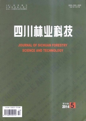
Volume 35 Issue 5
Nov.  2019
Article Contents
Turn off MathJax

SUN Cun-ju, LIANG Nan. Application of the Spectral Mixture Model in Extracting Vegetation Information in Chengdu City[J]. Journal of Sichuan Forestry Science and Technology, 2014, 35(5): 84-87. doi: 10.16779/j.cnki.1003-5508.2014.05.018
Citation: SUN Cun-ju, LIANG Nan. Application of the Spectral Mixture Model in Extracting Vegetation Information in Chengdu City[J]. Journal of Sichuan Forestry Science and Technology, 2014, 35(5): 84-87. doi: 10.16779/j.cnki.1003-5508.2014.05.018

Application of the Spectral Mixture Model in Extracting Vegetation Information in Chengdu City


doi: 10.16779/j.cnki.1003-5508.2014.05.018
More Information
  • Received Date: 2014-06-19
  • Landsat 8 images acquired on 20th of April in 2013 were used to extract vegetation information through a spectral mixture model in this research. Taking Chengdu city as an example, primary image was transferred into 7 bands through minimum noise fraction analysis and the first three bands were used to calculate the pure pixels. Four members including low-albedo building, high-albedo building, vegetation, and soil were selected as the input variables of land cover class terminal. Finally the vegetation coverage images in the study area were estimated.
  • 加载中
  • 加载中
通讯作者: 陈斌, bchen63@163.com
  • 1. 

    沈阳化工大学材料科学与工程学院 沈阳 110142

  1. 本站搜索
  2. 百度学术搜索
  3. 万方数据库搜索
  4. CNKI搜索

Article views(192) PDF downloads(1) Cited by()

Related
Proportional views

Application of the Spectral Mixture Model in Extracting Vegetation Information in Chengdu City

doi: 10.16779/j.cnki.1003-5508.2014.05.018
  • Sichuan Foresy Inventory and Plan Institute, Chengdu 610081, China;Jiange Forestry Bureau, Gangyuan 628300, China

Abstract: Landsat 8 images acquired on 20th of April in 2013 were used to extract vegetation information through a spectral mixture model in this research. Taking Chengdu city as an example, primary image was transferred into 7 bands through minimum noise fraction analysis and the first three bands were used to calculate the pure pixels. Four members including low-albedo building, high-albedo building, vegetation, and soil were selected as the input variables of land cover class terminal. Finally the vegetation coverage images in the study area were estimated.

Catalog

    /

    DownLoad:  Full-Size Img  PowerPoint
    Return
    Return